Taming the Flood

Civil engineer Iris Tien is helping coastal communities improve their resilience with the right flood-control infrastructure in the right places.
By Joshua Stewart | December 9, 2024
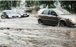
 Closed roads causing headaches for commuters. Power outages from downed lines. Homes and businesses damaged from rising water.
For many people who live near the southern coast, a summer thunderstorm can be more than an inconvenience. When they drop inches of rain in a flash, the storms can quickly overwhelm systems designed to carry away all that water. If they persist, rivers can swell, pushing water upstream and inland.
And, by all accounts, it’s only going to get worse.
A study in Nature published in the spring found many coastal areas might be underestimating their flood risk thanks to sea levels that are rising and land that’s sinking. High tides alone could create substantial flooding problems by 2050 in the 32 coastal areas the study’s authors evaluated. Places like Savannah, Georgia, and surrounding Chatham County are some of the most at risk communities.
As communities grapple with mitigating current and future flood risks, Iris Tien and researchers in her civil engineering lab are working to help. Her team is developing a framework to help residents and city planners identify the right kind of flood-control infrastructure and the right places to put it.
“One of the big gaps I saw while working with coastal communities is that a lot of these infrastructure decisions are made ad hoc,” said Tien, Williams Family Associate Professor in the School of Civil and Environmental Engineering. “It’s often not very systematic. It’s not really data-based. This also leaves the process open to potential bias, where you don’t necessarily develop these solutions for the places that need them the most.”
Gray or Green?
Since Tien is a civil engineer, it was natural for her to consider flood mitigation in the context of infrastructure systems. After all, her research focuses in part on infrastructure networks and the relationships and interdependencies between them.
For flood control, the choices largely come down to deciding between building “gray” solutions or “green” ones, each with their own benefits and costs. Gray infrastructure includes more traditional drainage systems and stormwater sewers. Green solutions could be ponds or basins, even parkland, that harness nature’s processes for collecting, managing, and slowly releasing floodwaters. Such systems also sometimes have additional benefits for the community that should be weighed when making decisions, Tien said.

“One of the things we wanted to do was to somehow account for the added multiple benefits of green infrastructure,” she said. “Those benefits can include increased access to green space, improved air quality, and potential educational opportunities. Green infrastructure might even increase access to healthy food if you incorporate a neighborhood garden.”
While those kinds of positives make green infrastructure popular with communities, they don’t mean it’s always the perfect choice.
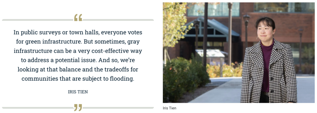
“In public surveys or town halls, everyone votes for green infrastructure. But sometimes, gray infrastructure can be a very cost-effective way to address a potential issue,” Tien said. “And so, we’re looking at that balance and the tradeoffs for communities that are subject to flooding.”
The tool Tien and her team are building models all of those factors using a spatial mapping approach. They’re using data such as the distances from existing infrastructure systems, maps of flood zones, locations of other community assets, and more. The spatial approach means it’s easy for the team to create visualizations for community stakeholders that help them see the recommendations.
Preferences Matter
Tien said they’ve also worked to incorporate the explicit preferences of the communities. Similar areas could end up with different recommended solutions or locations as a result.
“Everything is hyperlocal; a different city or community might care about different things,” Tien said. “If you value air quality and food production more, then you might be weighted more toward one type of solution. If you value lower costs or building onto an existing system, a lot of gray infrastructure can be built into an existing larger network, so then you might be weighted a little bit more that way.”
The key, she said, is meeting local needs while addressing the flooding issues. In a pilot project with Savannah-Chatham County, Tien’s team had conversations with a variety of stakeholders with different roles in making infrastructure decisions to inform their work. Planning and zoning staffers, stormwater engineers, and policymakers all brought different needs and perspectives to the table.
The goal isn’t to offer hard and fast prescriptions to build a specific kind of system in a specific location. Rather, the modeling will provide decisionmakers with a suite of ideal options to help them allocate their limited resources.
The next step is to beef up the hydrological modeling part of Tien’s framework in hopes of calculating a return-to-normal timeframe estimate after a storm event with different infrastructure approaches. Knowing the real-world performance of a particular solution, green or gray, would help flood-prone areas make informed choices.
“We’re building those probabilistic models to see, if you have a likelihood of this level of event, then with these different solutions, can we quantify what the benefit is of one versus another? I think it’s important to dig a bit deeper on the engineering side and actually produce numbers: it’ll take three days to return to normal or six hours or whatever the number might be,” Tien said.
Mitigating coastal flooding for more resilient and sustainable communities continues a thread of Tien’s work along the Georgia coast. For years, she has collaborated with other Georgia Tech researchers on a project installing sea-level sensors throughout Chatham County to monitor water levels and report data in real-time. This includes recent work creating a tool to help coastal areas find ideal spots for water level sensors considering flood risk, population vulnerability, and more. Her gray and green infrastructure decision-making framework complements those efforts by adding long-term planning resources for coastal residents and local officials.
Tien said research efforts like these highlight how important it is to engage directly with communities to develop practical solutions.
“We want our research to be serving real needs to make real, positive community impacts.”
Leave a Reply